Geotechnical investigation in Visalia forms the critical foundation for safe, code-compliant construction across California's San Joaquin Valley. This category encompasses the systematic evaluation of subsurface soil, rock, and groundwater conditions to guide foundation design, earthwork, and infrastructure development. In a city experiencing steady residential and commercial growth, understanding what lies beneath the surface is not merely a regulatory checkbox but a fundamental engineering necessity. The process typically involves field exploration, laboratory testing, and engineering analysis to characterize soil bearing capacity, settlement potential, liquefaction susceptibility, and expansive soil behavior. For projects ranging from single-family homes to large-scale agricultural processing facilities, a thorough investigation identifies potential geohazards and informs mitigation strategies that protect structural integrity and long-term investment.
Visalia's location on the alluvial fans of the Kaweah River and adjacent to the seismically active Sierra Nevada foothills creates a unique geological profile that demands careful study. The near-surface soils predominantly consist of sandy loams, silty clays, and occasional gravel lenses deposited over millennia. These formations exhibit variable consolidation and can include pockets of loose, saturated sands that are particularly susceptible to earthquake-induced liquefaction. Deeper strata often transition into older, denser alluvium and the underlying Tulare Formation. Groundwater levels fluctuate seasonally and are influenced by agricultural irrigation and drought cycles, sometimes rising to within a few feet of the surface. The presence of expansive clay minerals, especially in the eastern portions of the city, introduces shrink-swell hazards that can severely damage shallow foundations if not properly identified and accommodated in the structural design.
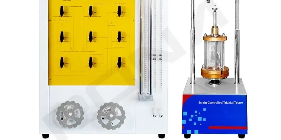
All geotechnical investigation work in Visalia must adhere to the stringent requirements of the California Building Code (CBC), which incorporates by reference the International Building Code (IBC) with state-specific amendments. The CBC mandates site-specific soil investigations for most new construction, with Chapter 18 detailing the minimum scope for borings, sampling intervals, and laboratory testing protocols. For projects within special seismic zones, including much of Tulare County, compliance with the California Geological Survey's Special Publication 117 is essential for liquefaction assessment. Environmental due diligence often runs parallel, governed by federal and state regulations such as CERCLA and the Porter-Cologne Water Quality Control Act. Licensed geotechnical engineers and certified engineering geologists must stamp all reports, and local building departments rigorously review investigation submittals before issuing permits.
A wide spectrum of project types in Visalia rely on comprehensive geotechnical investigation. Residential subdivisions require evaluation of cut-and-fill stability and pad preparation, while commercial developments like retail centers on Mooney Boulevard need precise bearing capacity analyses. Agricultural infrastructure, including packing houses and cold storage facilities, often involves heavy floor loads and specialized drainage considerations. Public works projects, such as the expansion of Visalia Municipal Airport and new school facilities, demand rigorous testing to meet public safety standards. Even minor additions or retaining walls can trigger the need for a site-specific investigation. A key component of many investigations is the CPT (Cone Penetration Test), which provides continuous soil profiling and is extensively used for liquefaction screening in the region's sandy alluvial deposits. This in-situ method complements traditional borings and laboratory testing to create a robust subsurface model.
Available services
Top questions
Why is a geotechnical investigation mandatory for most construction projects in Visalia?
The California Building Code requires site-specific soil investigations to ensure foundation designs account for local conditions like expansive clays and liquefaction-prone sands. This protects structural safety, confirms bearing capacity, and satisfies local building department requirements before permits are issued.
How do Visalia's geological conditions influence the scope of a subsurface investigation?
The alluvial fan deposits near the Kaweah River create variable soil profiles with loose sands and silty clays. Investigations typically require deeper borings to assess liquefaction potential under seismic shaking, evaluate seasonal groundwater fluctuation, and identify expansive soil zones common in eastern Visalia.
What is the typical timeline for completing a full geotechnical investigation in this area?
A standard investigation for a commercial site usually takes three to five weeks from field mobilization to final report delivery. This includes drilling, laboratory testing for soil classification and strength, engineering analysis, and report preparation with foundation recommendations tailored to the project.
Which types of field testing are most effective for characterizing soils in the San Joaquin Valley?
Standard Penetration Test borings combined with Cone Penetration Testing deliver comprehensive data. The CPT is particularly effective for continuous profiling of alluvial sands and silts, enabling detailed liquefaction analysis, while borings allow for undisturbed sampling of cohesive layers for laboratory strength testing.